
-
Top 4 Best Places to Picnic
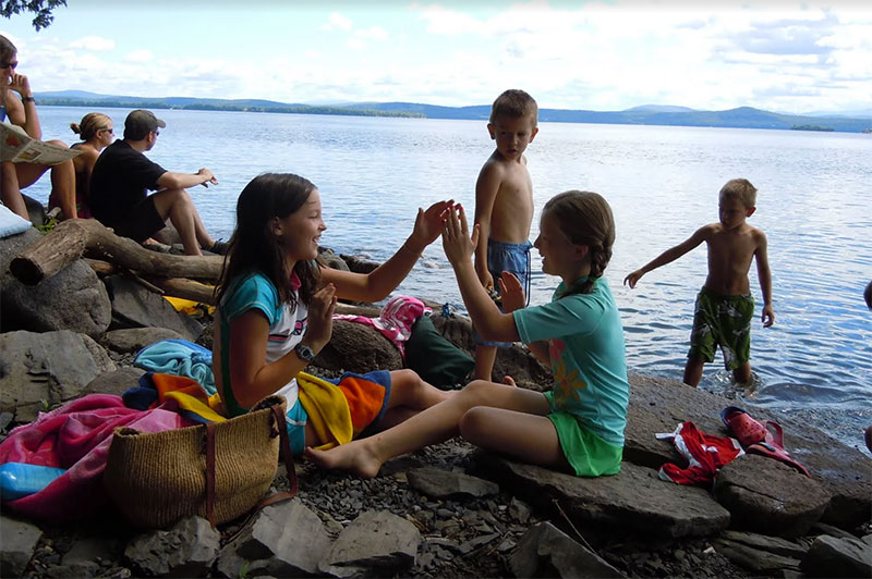
Whether looking for something fun to do for a quick date or showing off the North Country to out-of-town guests, we’ve combed the area looking for the best places to picnic. Some of these locales are Seven Daysies Award-Winners while some are haunts we’ve check out on our own:
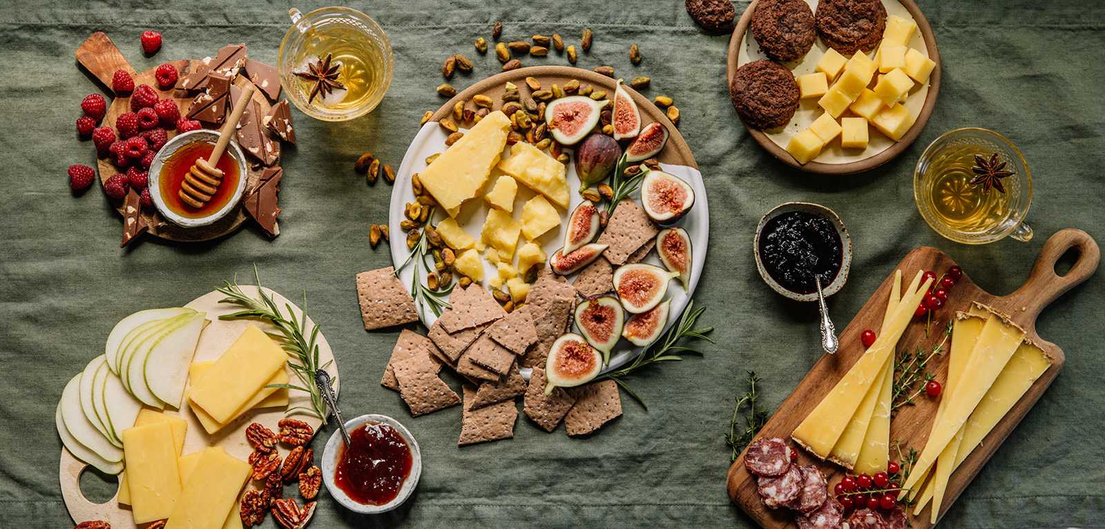
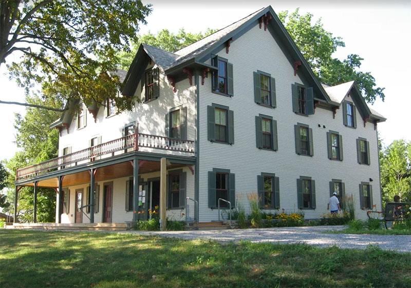
- Shelburne Farms – Located off Route 7, the majestic farm and seasonal mansion offer $40 picnic basket for two with a pre-made box, available exclusively to Shelburne Farms Inn guests and bar patrons for $40. This curated selection showcases the finest local flavors, including Shelburne Farms’ cheddar, salami from Agricola Farm, crisp apples, jam, and crackers. Enhance your picnic experience with additional treats from the Farm Cart or a freshly baked loaf from O Bread Bakery, both conveniently located on the property.
- Mt. Philo State Park – If you continue south on Route 7, hang a left and head up Mt. Philo. Whether taking the 2 mile hike up the paved road or driving up, the view does not disappoint! Pack your own picnic, sit in the Adirondack chairs and enjoy!
- Crown Point State Park – About an hour south, you can enjoy the ruins of the French and British colonial wars while munching on your picnic looking at the beauty of Lake Champlain.
- Fort Ticonderoga – Now this is a jaunt, (maybe 1 1/2 to 2 hour drive,) but certainly worth it for the history buff! Corn mazes, the Fort and adventure await
-
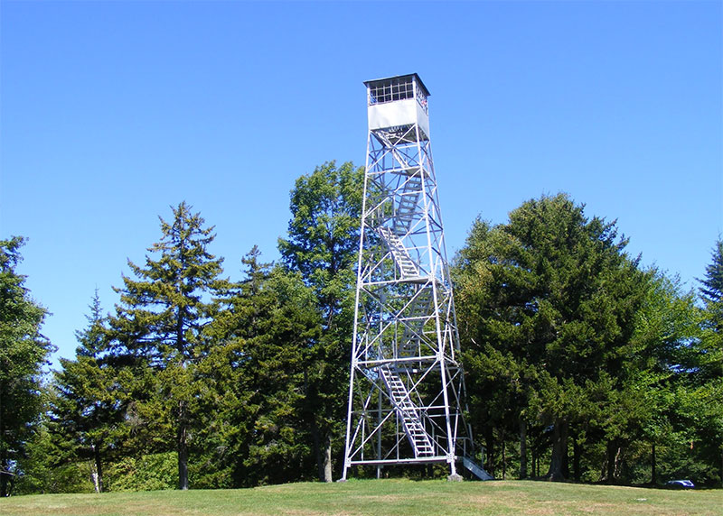
Allis State Park
Allis State Park
Randolph, VT
Allis State Park was established in 1928 as Vermont’s second developed state park. The park is named for Wallace Allis, who willed his Bear Mountain Farm to the State of Vermont to be developed as a campground and recreational area. It is located on the summit of Bear Hill which provides sweeping views of central Vermont from a lookout tower once used to spot forest fires. On a clear day, Killington, Pico, and Mt Ascutney peaks are visible to the south; Camel’s Hump and Mt. Mansfield to the north; Abraham, Lincoln, and Ellen to the west; the White Mountains of New Hampshire to the east. The fire tower has an information panel explaining the view. The property was in the Allis family for several generations as a working farm. The entire hill was open pasture land with excellent views from just about any spot. Mr. Allis allowed the public to enjoy the views from the hill; its popularity led him to leave it to the State. Today, all that remains as evidence of the farm are many stone walls that crisscross the property. The park was developed by the Civilian Conservation Corps (CCC) beginning in 1932. They built up the access roads, constructed a massive timber picnic shelter, picnic grounds and a campground. The park has undergone several improvements and changes in operations since that time.Facilities:
- 18 tent sites
- 8 lean-to sites
Activities:
Camping, hiking, picnicking, horseshoes
MORE INFO ON THIS PARK HERE!
-
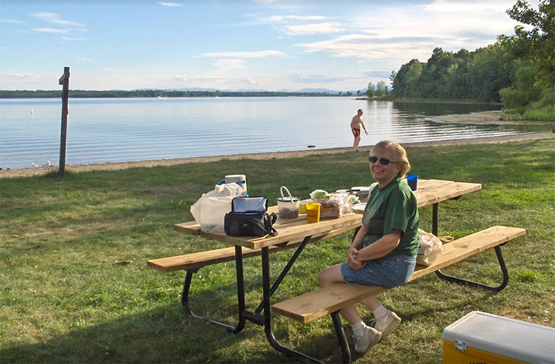
Knight Point
Knight Point
North Hero, VT
Knight Point on North Hero IslaKnight Point on North Hero Island opened as a state park in 1978, but its history goes back much further. John Knight, the point’s first resident, began ferry service between the islands in 1785. His family operated a ferry until the first bridge opened in 1892. Expansive lawns are the center of this 54-acre day use park. The lawn becomes meadow west of the developed area, where the forest along the lakeside is a substantial natural feature. Besides stands of mature, windswept oak and maple on the point, hickory and hop hornbeam are found further inland. Tight clusters of cedar trees enhance the beauty and wildlife cover of the area. The cobbled shoreline, west of the swimming beach and extending around the point, is a State Natural Area. It’s the largest undisturbed example of this type of natural community on Lake Champlain, and is home to an unusually diverse group of rare plant species. A walking trail loops around the point to offer scenic lake and shore vistas, plus intimate opportunities for close-up nature and forest viewing. A connecting path cuts through the meadow for those wishing to shorten the walk. Both trails are wide and easy to follow.Facilities:
- Day use but no camping
Activities:
Hiking, swimming, boating, stand up paddleboarding, disc golf, fishing, picnicking
MORE INFO ON THIS PARK HERE!
-
Knight Island
Knight Island
Knight Island, VT
Along with Burton Island and Woods Island state parks, Knight Island, acquired by the State in 1990, is one of three neighboring island parks in Lake Champlain’s “inland sea”. This 185-acre island is a mile long and nearly a half mile wide. The park includes all but 10+ acres of private land on the island’s southern tip. When on Knight Island, please respect the rights of the park neighbor and keep off the southern end.
The island was farmed historically then was uninhabited for many years. It was a privately operated primitive campground through the 1980s. The owner lived year-round on the island and began a timber management program to supplement the camping operation. Under state ownership, remote area camping has been continued on seven sites dotted around the island. Land management activities are those which will keep the island unique and unspoiled.
Facilities:
- Remote only via boat
- 1 tent site
- 6 lean-to sites
Activities:
Remote camping, hiking, swimming, boating, fishing
MORE INFO ON THIS PARK HERE!
-
Kill Kare
Kill Kare
St Albans, VT
This state park is named for Kill Kare, a summer camp for boys, which operated on this site from 1912 until 1966. Located on the southwestern tip of St. Albans Point, a three-mile peninsula that defines St. Albans Bay, Kill Kare is surrounded on three sides by the sparkling water of Lake Champlain. The three-story building in the center of the park was built in the 1870’s and operated as a summer resort hotel known as The Rocky Point House. The hotel operated off and on under various owners until 1912, when the boys’ camp purchased the property. Besides the big hotel building, known as “The Main House,” during the camp years, the camp included tennis courts, a baseball field and several small cabins.
Recognizing the need for a mainland base from which to service Burton Island State Park, the State of Vermont purchased the 17-acre Kill Kare property in 1967 after the camp closed. The cottages were removed, and the boat ramp was created on the east shore. The breakwater was built to protect the boat ramp and ferry dock. Some group picnicking was allowed on the grounds, but the primary purpose of the park, in the early days, was to support Burton Island. It was not until the mid-1970’s, a period during which water quality within St. Albans Bay was particularly poor, that the public began to come swimming and picnicking at Kill Kare, and to appreciate the park for its clean water and cooling summer breezes.
In the early 1980’s the park became so popular that modernization became necessary. The Rocky Point House was renovated in 1982, but by 2009 more significant improvements were needed. In 2010, the hotel building was completely renovated to reflect the original lakeside hotel architecture. The Vermont Division for Historic Preservation, partnered with the Department of Forests, Parks and Recreation on the project; The Rocky Point House is considered to be historically significant to not only the community of Saint Albans, but to the citizens of the entire state. The stately architecture of the finished project closely resembles the original lakeside hotel as it stood in the late 1800s. The Rocky Point House architecture exudes a feeling of class, elegance and distinction; patrons of this establishment who sought recreational enjoyment of Lake Champlain would have expected this level of sophistication. The State of Vermont is proud to have saved this historic lakeside hotel.
Facilities:
- Day use, but no camping.
Activities:
Swimming, boating, stand up paddle boarding, fishing, picnicking
MORE INFO ON THIS PARK HERE!
-
Grand Isle
Grand Isle State Park
Grand Isle, VT
There are 115 tent/RV sites, 36 lean-to sites, and 4 cabin sites, making the campground Vermont’s second-largest. Grand Isle State Park was opened in 1959 when 54 acres of land was purchased from Birchcliff, a private summer resort. The original acquisition included a hotel-like building, cabins and a recreation hall. Today’s nature center is the last remaining Birchcliff building. Three additional property acquisitions brought the park to its current 226-acre size. Park development during the 1960’s was spurred by a successful effort to attract visitors to the area by providing quality camping opportunities.
Today, the result of that effort is apparent. Grand Isle State Park is the most-visited campground in the state park system. With 4,150 feet of Lake Champlain shoreline, Grand Isle is popular with many destination campers who spend their entire vacation here. At the same time, the park location on US Route 2 attracts a high number of one-night campers, while proximity to population centers in Burlington, Vermont and Montreal, Quebec make it an easy destination for the weekend or spur-of-the-moment camper. Park property extends all the way west to Route 2, where part of the land is being kept open by agricultural lease, and some of what was pasture thirty years ago has reverted to woodland.
Facilities:
- 115 tent/RV sites
- 36 lean-to sites
- 4 cabin sites
Activities:
Camping, hiking, swimming, boating, fishing, nature programs, horseshoes, volleyball
MORE INFO ON THIS PARK HERE!
-
Alburgh Dunes
Alburgh Dunes
Alburgh, VT
This 625-acre property became a state park in 1996. It is named for the sand dunes near the center and western end of the south-facing, natural sand beach. This beach is amongst the longest beaches on Lake Champlain.
The beach and dunes together make up what is known as a barrier island, geologically similar to coastal formations more common along ocean shorelines. At Alburgh Dunes, the sand has come from a layer of glacial till- the soil that was left atop the low bluffs southeast of the beach when the last glacier melted. The bluffs have eroded over thousands of years, and the soil carried off by lake currents. Sand from that soil settles out in the pocket between the rocky “Point of Tongue” to the east and “Coon Point” to the west, forming the beach. The wetland behind the beach includes the largest black spruce bog in Grand Isle County. Black spruce swamps and bogs are more typical of colder, northern climates than of the Champlain Valley, which is Vermont’s warmest area. Core samples from the bog reveal peat to depths of more than 8 meters (26 feet). From these samples comes a record of climate and vegetation dating back to the ice age, and further evidence of isostatic rebound.
Alburgh’s wetlands are important to wildlife, providing habitat for breeding, feeding, nesting, and over wintering. The park’s wetlands and adjacent white cedar forest uplands are the primary components of the largest and most important deer wintering area in Grand Isle County. Wild turkey, too, are abundant in and around the area. Alburgh Dunes certainly lends itself to wildlife viewing!
Facilities:
- 56 tent/RV sites
- 19 lean-to sites
Activities:
Day use, but no camping.
MORE INFO ON THIS PARK HERE!
-

Stillwater
Stillwater
Groton, VT
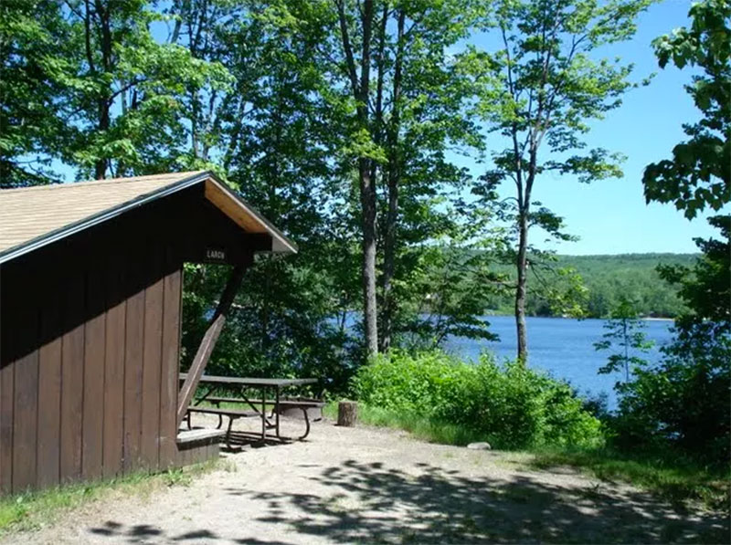 This park is one of seven parks in the Groton State Forest. These parks are all within close proximity to one another (some within walking distance) and entry to one provides free entry to all. Combined, the parks offer a range of activities and attractions.
The rocky hillsides were originally cloaked in white pine, spruce, hemlock, beech, maple and birch. These were logged by local farmers for lumber, fuel and potash. The logging industry was large-scale for almost 100 years while the railroad operated. Today, logging is still a vital industry but has lost its dominance in favor of modern society’s leisure culture: private cottages/seasonal homes; park development; and a variety of outdoor recreation activities. Groton State Forest, with over 26,000 acres, is the second largest land block administered by the Department of Forests, Parks and Recreation. The forest contains over 17 miles of hiking trails and over 20 miles of gravel roads and multi-use trails suitable for mountain biking and horseback riding. The newly opened Groton Nature Center is nearby.
Facilities:
- 56 tent/RV sites
- 19 lean-to sites
Activities:
Camping, hiking, swimming, boating, fishing, nature programs, picnicking, mountain bikes, horseshoes
MORE INFO ON THIS PARK HERE!
-
New Discovery
New Discovery
Marshfield, VT
This park is one of seven parks in the Groton State Forest. These parks are all within close proximity to one another (some within walking distance) and entry to one provides free entry to all. Combined, the parks offer a range of activities and attractions. The newly opened Groton Nature Center is nearby.
The rocky, tree covered hillsides were originally cloaked with white pine, spruce, hemlock, beech, maple and birch. These were logged by local farmers for lumber, fuel and potash. The logging industry was large-scale for almost 100 years while the railroad was operating. Today, logging is still a vital industry in the area, but has lost some of its dominance in favor of modern society’s leisure time movement – private cottages/seasonal homes and a variety of outdoor recreation activities.
Osmore Pond has seven remote campsites. Four are lean-to’s and three are tent sites with platforms. Remote tent sites 15 & 16 have 10′ x 12′ platforms and site 17 has an 8′ x 10′ platform.
There is an eight-site horse camping area located in New Discovery State Park. Groton Forest is the second largest state forest in Vermont with over 26,000 acres to explore. Trails for horseback riding in the park include gravel-surfaced roads, forest highways (logging roads), the VAST trails, and the Montpelier-Wells River Rail Trail.
Facilities:
- 8 tent/RV sites
- 15 lean-to sites
- 8 horse-camping sites
- There are also 4 remote lean-tos and 3 remote tent sites at Osmore Pond.
Activities:
Camping, hiking, playground, swimming, boating, fishing, nature programs, picnicking, mountain bikes, horseshoes
MORE INFO ON THIS PARK HERE!
-
Little River State Park
Little River State Park
Waterbury, VT
In the early 1800s, pioneers cleared fields, rocks, and stumps in Ricker Basin and Cotton Brook. A settlement of 50 or so families once lived in this area. The hard demands of the land and weather forced younger generations to abandon the farms.
Today, old cemeteries, sawmill remains, old town roads, bridges and many cellar holes can still be seen as evidence of a past community.On November 3 and 4 of 1927, torrential rains caused local rivers to rise and drove residents to their roofs. Between 1935 and 1938 the Civilian Conservation Corps (CCC), in cooperation with the U.S. Army Corps of Engineers, constructed Waterbury Reservoir. The CCC camp here was a fully operating, thriving community with more than 80 buildings, and housing 2,000 men at its peak. Now, half a century later, only a few solitary chimneys and concrete foundations remain.
Today, Little River State Park is one of the most popular parks in central Vermont. Waterbury Reservoir is particularly favored for boating with a portion of the reservoir devoted to quieter uses. Angling for bass and trout is as popular here as water-skiing.>
Enjoy swimming beaches, play areas, boat rentals and a launch, and miles of hiking and mountain bike trails in the adjacent Mt. Mansfield State Forest. Self-guided history and nature trails are located close to the camping area.
Facilities:
- 81 tent-sites
- 20 lean-to sites
- 5 cabins
- There are also 27 remote campsites along the Waterbury Reservoir shoreline that are only accessible by boat
Activities:
Camping, hiking, swimming, boating, fishing, nature programs, mountain biking, volleyball
MORE INFO ON THIS PARK HERE!
Vermont State Parks


![]()
![]()
Learn to create professional videos and have fun in the process of creating videos.
Video Review And Collaboration.